
These are direct links to historic maps online that are limited to a specific subject.
General reference maps can be found in the Historic maps section.
For entire collections, see also Sources and links
 |
Chicago growth, decade by decade |
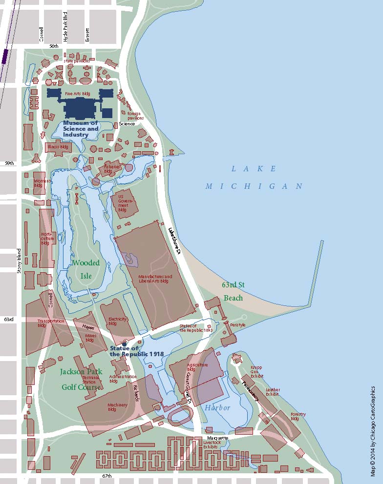 |
World's Columbian Exposition site today |
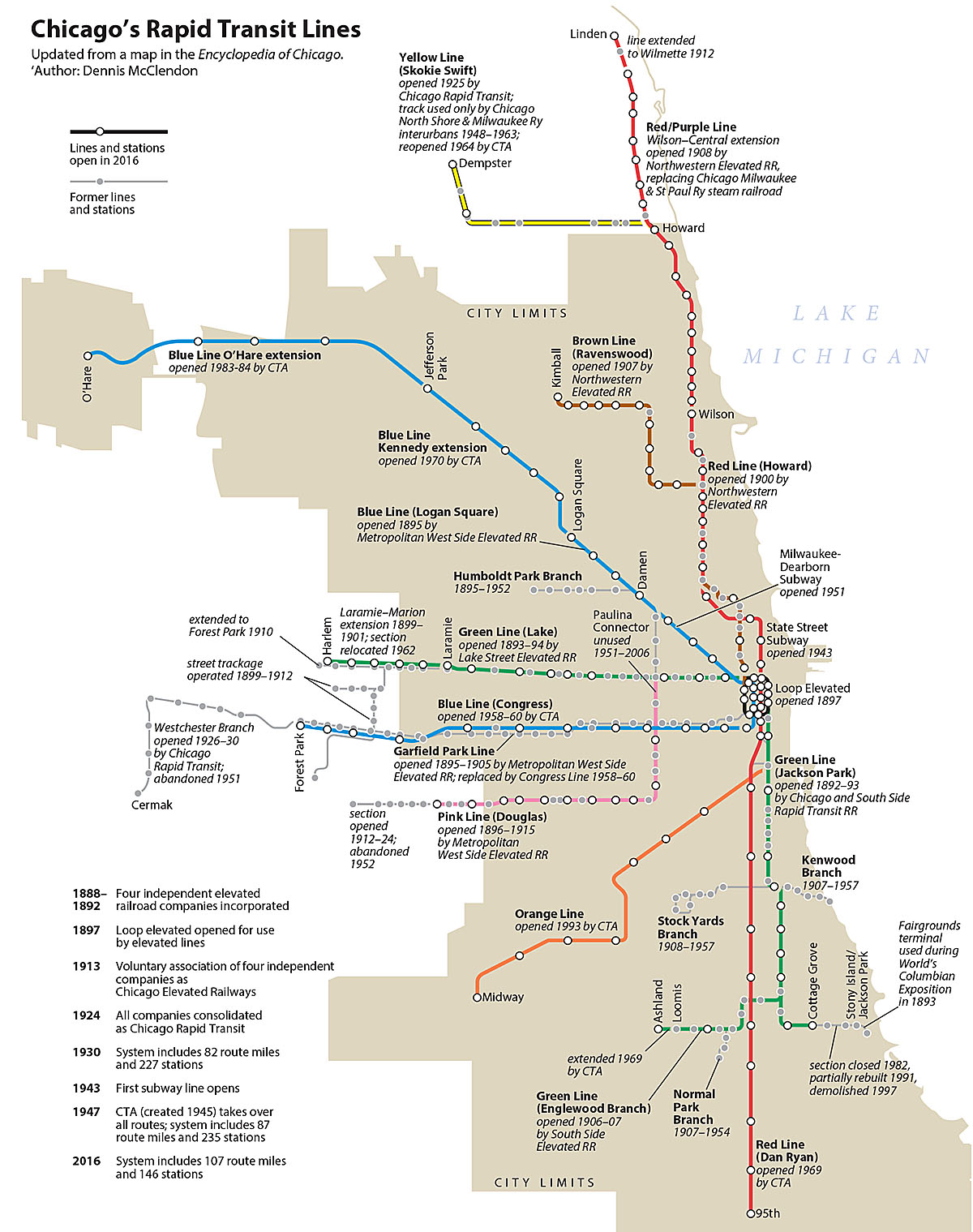
Chicago rapid transit history |
 |
 |
 |
Chicago water works system in 1896 |
 |
Original surveyor plats of Illinois townships |
 |
Redlining maps |
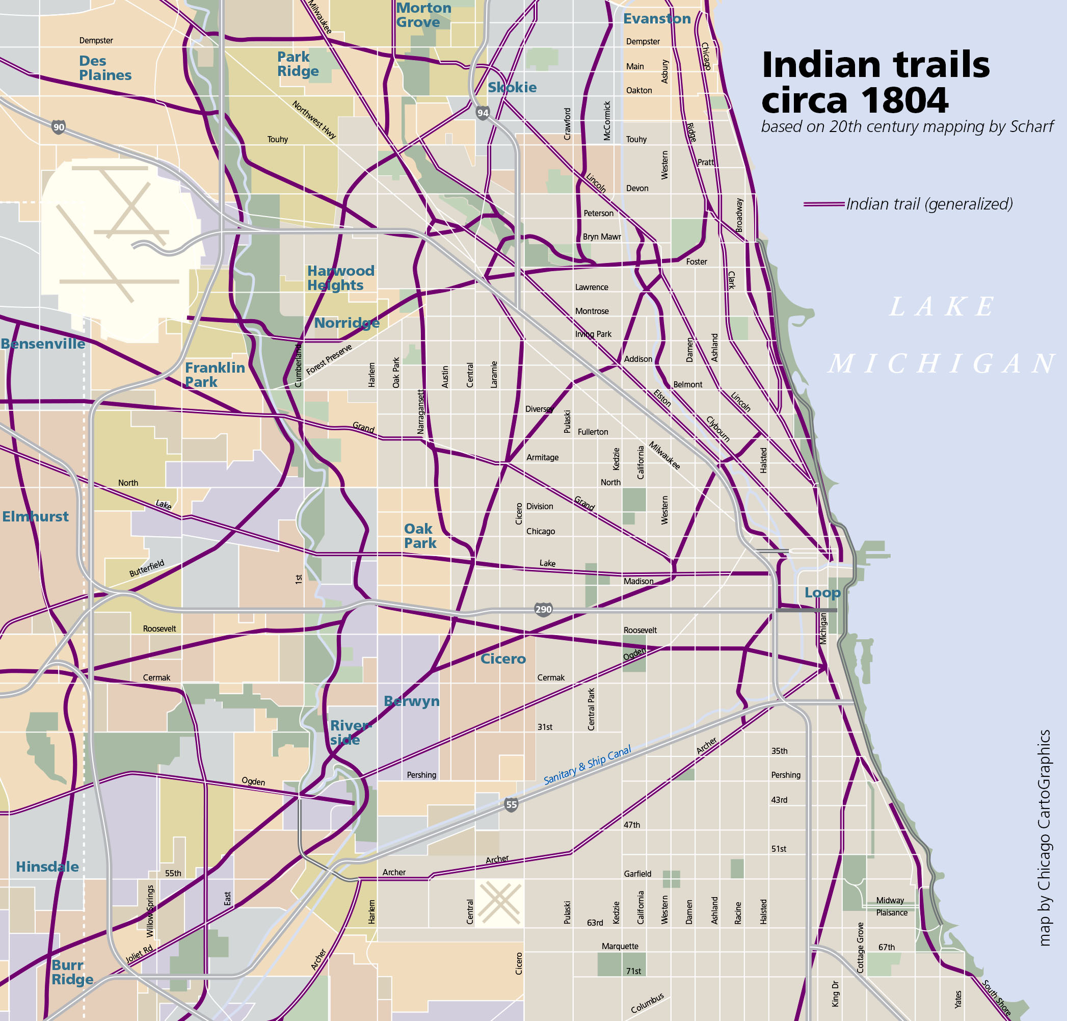 |
Indian trails of the Chicago area |
Geological maps of Chicago
 |
Chicago Loop quadrangle |
 |
Lake Calumet quadrangle |
Complete portfolio of Chicago Area Geologic Maps
Chicago railroad maps
 |
Smoke Abatement maps of Chicago railroads & industry |
 |
Smoke Abatement map of Chicago railroads & industry 1915 |
 |
Open Railway Map |
Chicago transit map collection online at Illinois Railway Museum
Chicago transit maps from Chicago-L.org:
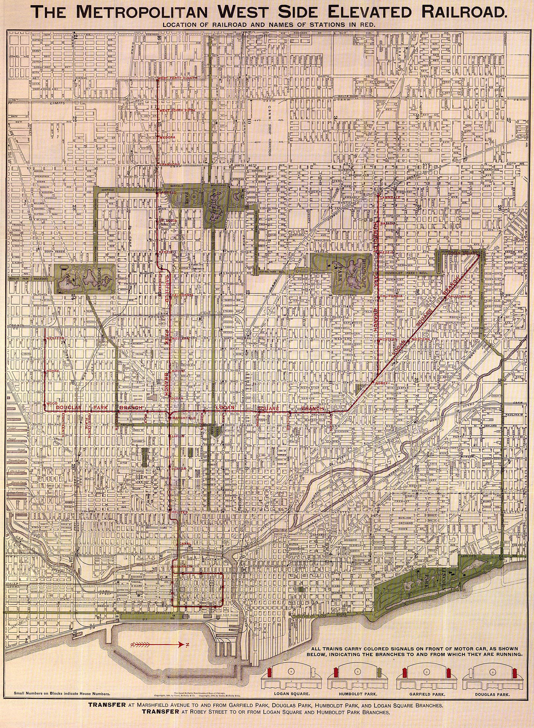 |
1898 | Metropolitan West Side Elevated Railroad |
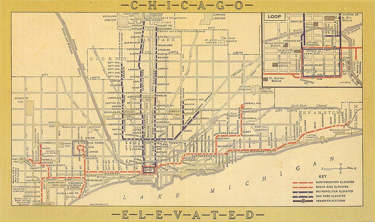 |
1913 | Chicago Elevated Railways system map |
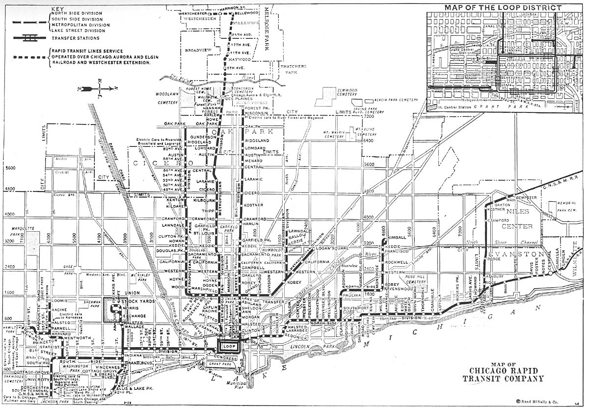 |
1926 | Chicago Rapid Transit system map |
 |
1933 | Chicago Rapid Transit system map |
 |
1946 | Chicago Rapid Transit system map |
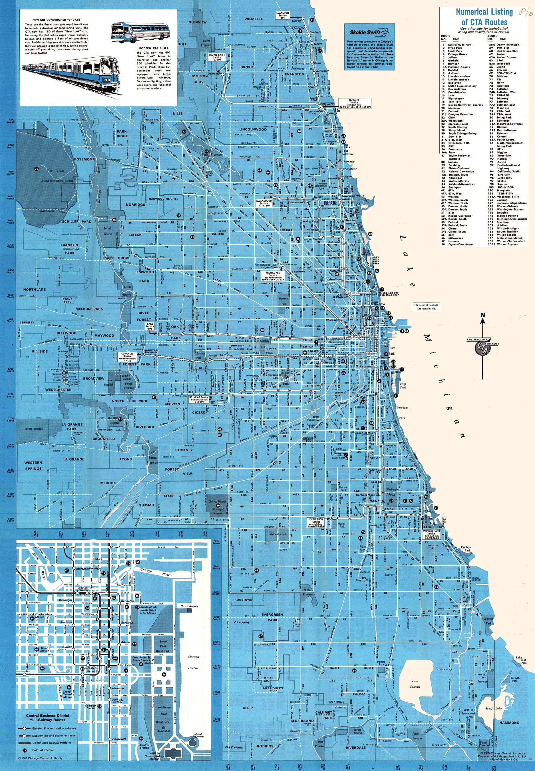 |
1965 | Chicago Transit Authority system map |
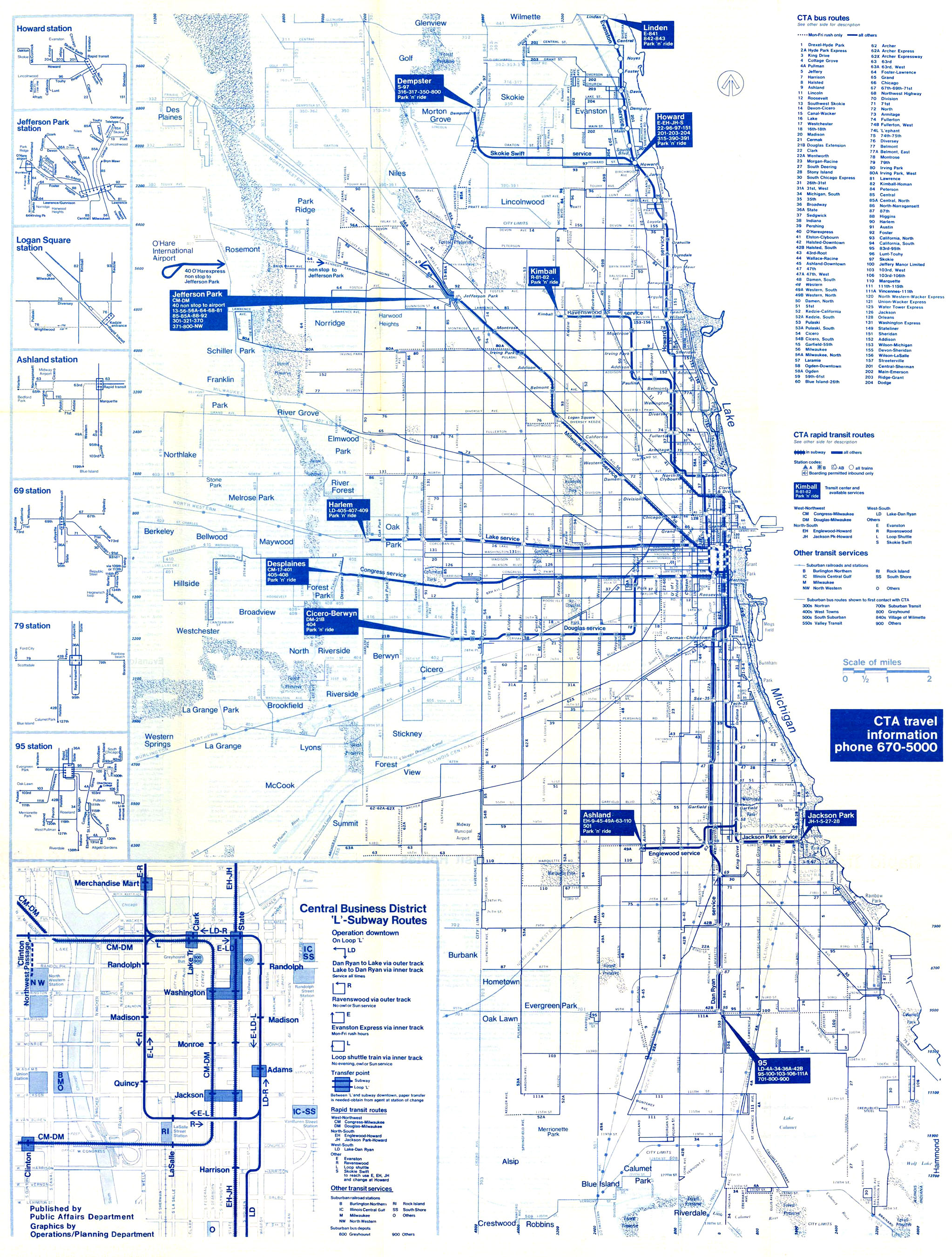 |
1975 | Chicago Transit Authority system map |
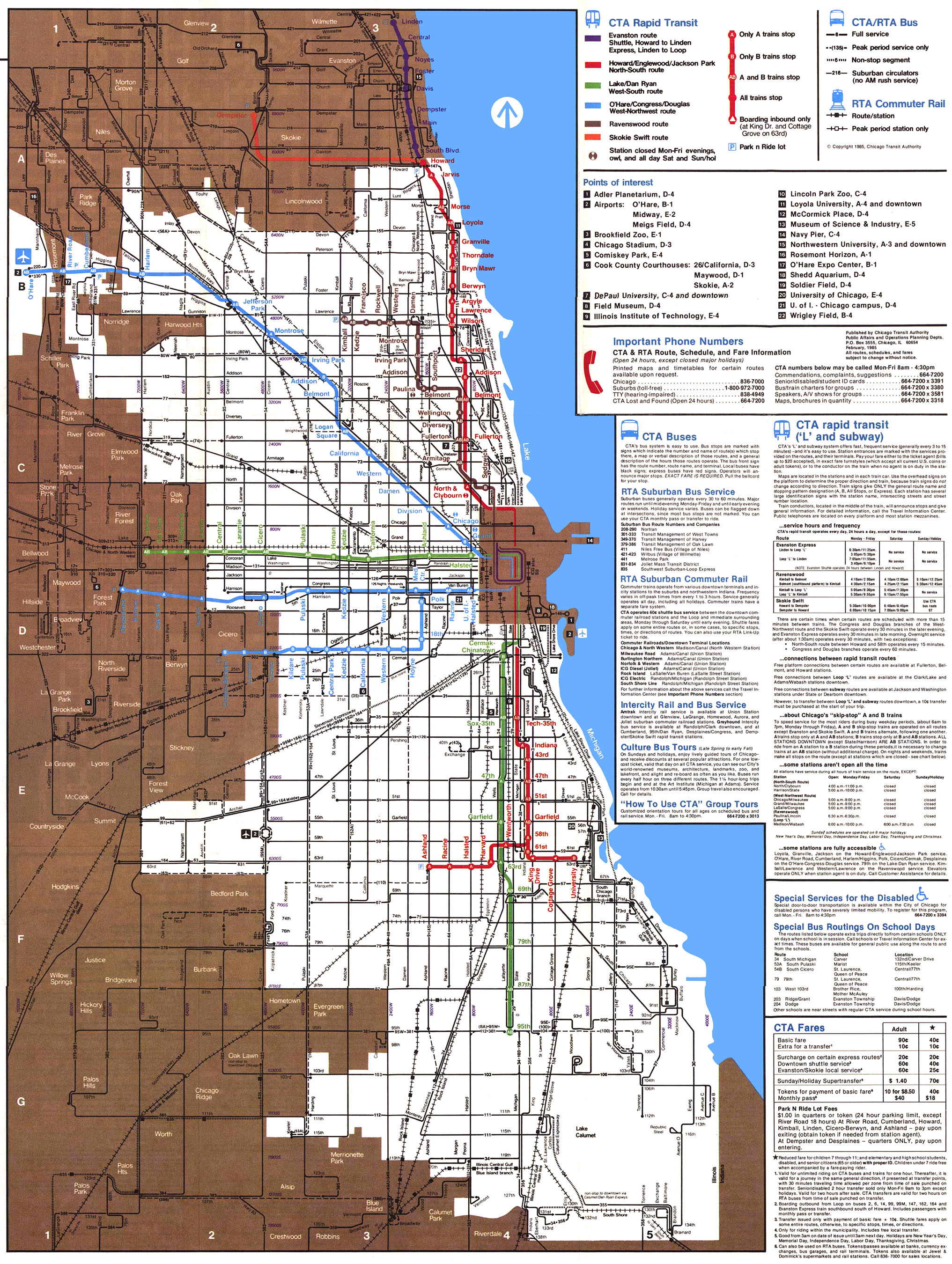 |
1985 | Chicago Transit Authority system map |
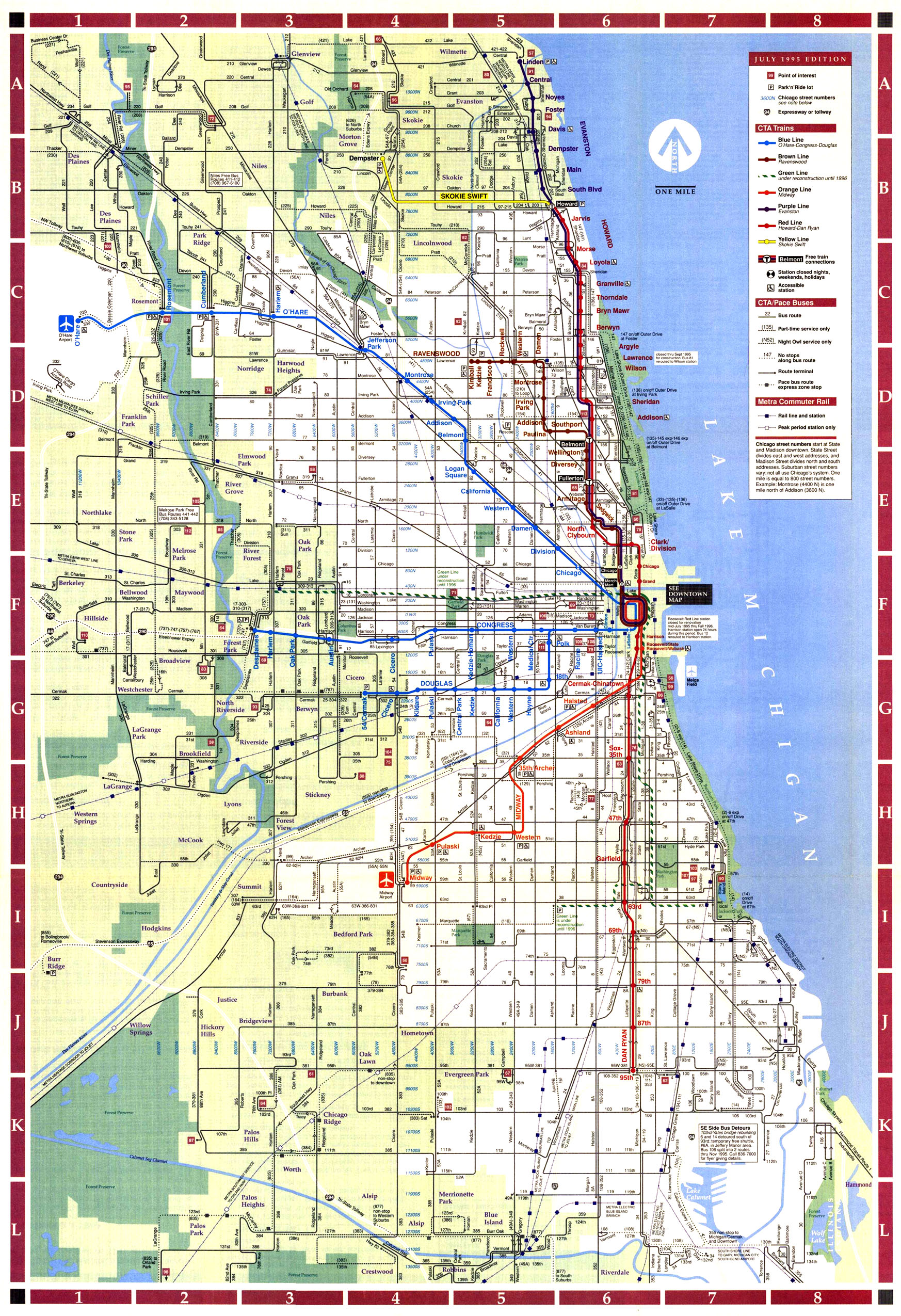 |
1995 | Chicago Transit Authority system map |
 |
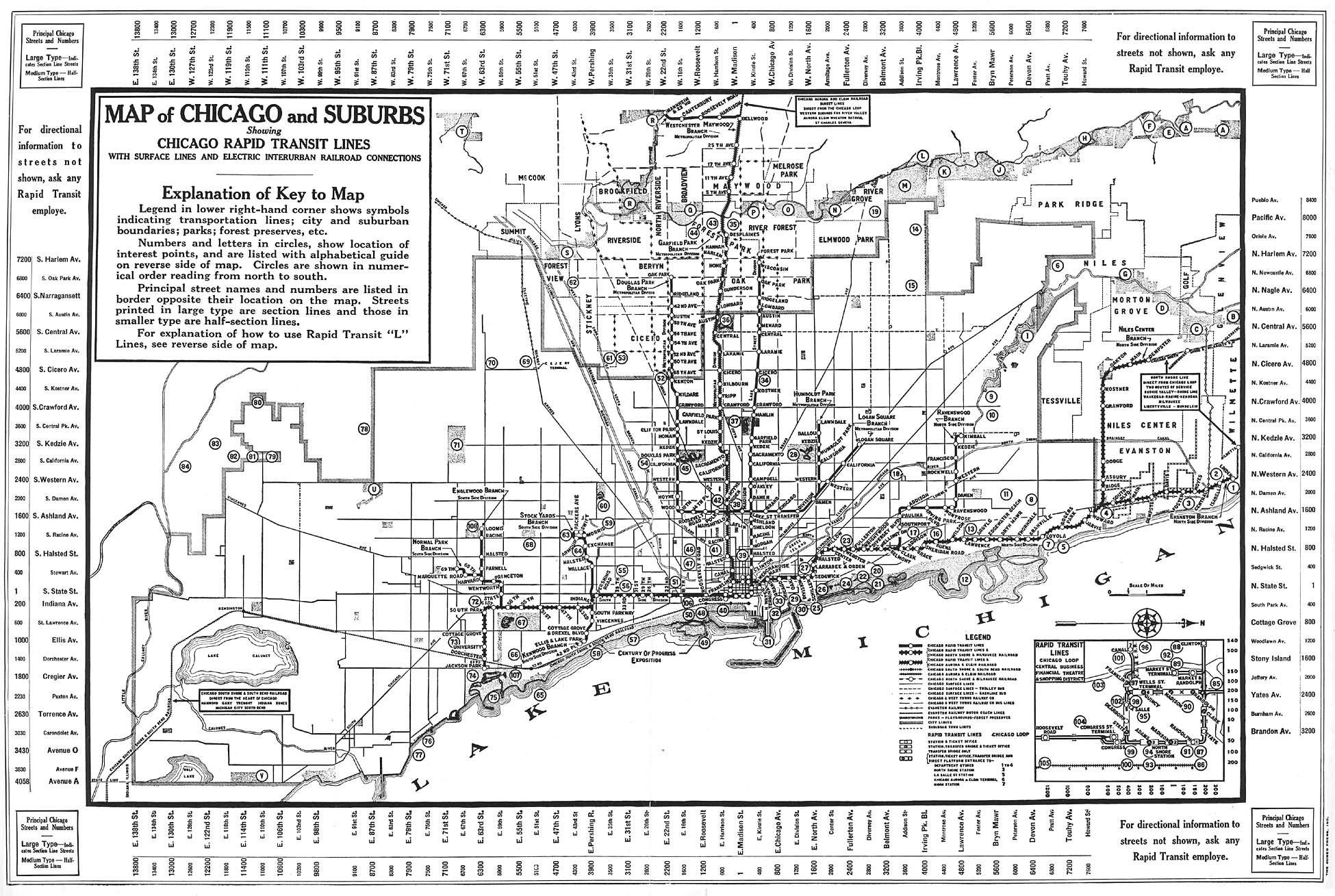
vary | Chicago Transit Authority track maps |