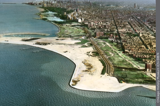
Hundreds of acres of new parkland (green) were created along Chicago’s lakefront between 1910 and 1960.
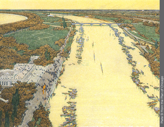
A birds-eye view shows the extensive landfill Burnham proposed between downtown and Jackson Park. Offshore islands would shelter quiet lagoons, providing new shorelines and sites for pavilions and ballfields.
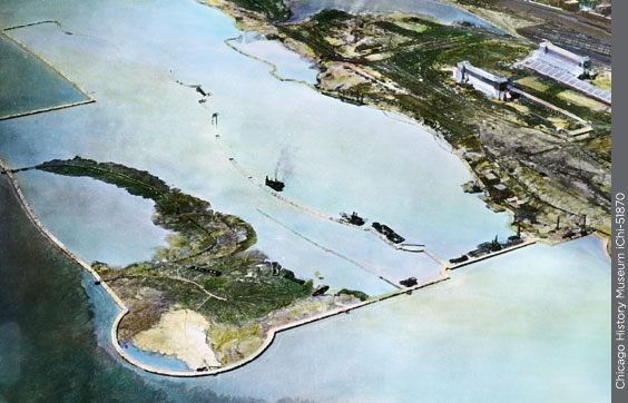
Offshore islands would shelter quiet lagoons, providing new shorelines and sites for pavilions and ballfields.
Northerly Island, first of a chain planned for the south lakefront, was created in the late 1920s (above). It was the site of the 1933-34 Century of Progress Exposition (below). After World War II, it was offered as the site for the United Nations, then became Meigs Field airport in 1948.
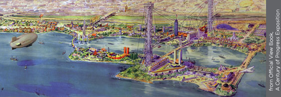
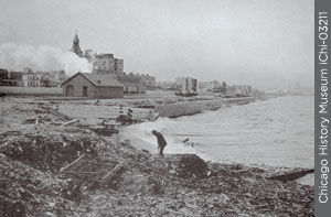
The south lakefront was little more than a dumping ground at the time.
The improvement of the Lake front from Winnetka to the Indiana line is an economic necessity.
—Plan of Chicago, p. 122
Perhaps the Plan’s most treasured legacy is the city’s public lakefront, unique in the world. When the Plan was written, only a quarter of the city’s shoreline was publicly accessible. Private land extended to the water north of Diversey Parkway and south of 67th Street. From downtown to Hyde Park, the Illinois Central Railroad tracks dominated the shoreline.
But Lincoln and Jackson Parks provided inspiring examples of public lake shorelines, busy bathing beaches, and calm inland lagoons. “The Lake front by right belongs to the people,” declared the Plan. “It affords their one great unobstructed view, stretching away to the horizon, where water and clouds seem to meet. . . . Not a foot of its shores should be appropriated by individuals to the exclusion of the people.” Burnham sketched a series of peninsulas and offshore islands carrying a parkway and sheltering new lagoons
Landfill operations had already expanded Lincoln and Grant Parks, but Burnham pointed out that the city was annually disposing of one million cubic yards of clean fill—mostly ashes from coal-burning boilers and dirt removed for basements—by dumping it far out in the lake. That was enough to create more than 20 acres of landfill if dumped close to shore. Park authorities eagerly adopted this idea in the 1920s and 1930s. Along the south lakefront, Northerly Island, Burnham Park, and Promontory Point were created. Lincoln Park, 450 acres when the Plan was written, was expanded to 1,200 acres by the 1950s.
Burnham’s vision was not of an exclusively recreational lakefront. Great Lakes shipping was crucial to the region’s economy, and the Plan anticipated extensive new piers and harbors. But public access and recreational areas were to be cleverly integrated with new slips and loading docks, in a way seen nowhere else in the world.
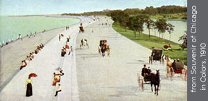
When the Plan was written, Lake Shore Drive was a short pleasure drive through Lincoln Park (above). By 1935 it was an urban expressway, extended north as landfill created new parkland (left).