
|
M A P S F O R T H E W E B Web maps
are not just paper maps that have been scanned; they present their own
challenges and opportunities. Color schemes are different, small type
must be kept readable, and the images must be optimized for rapid download.
|
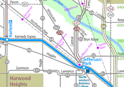 |
For 15 years, we subtly refined the design of the Chicago Transit Authority system map, and in 1997 we developed a pioneering way to display this large, detailed map on the web without requiring browser plugins or even broadband access, by dividing it into logical sections for shorter download time. View this version at CTA’s website. |
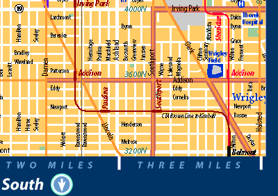 |
We developed a web-friendly version of Chicago's bike map, including innovative tools to bring you quickly to the map you want (it takes nearly 300 maps to cover the whole city). See the full website here. |
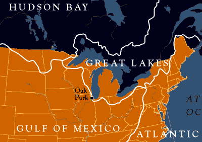 |
The Rotary Club of Oak Park put up markers to bring attention to the nearly imperceptible “continental divide” that runs west of Chicago. Also part of the project: brochures and a website telling the story. |
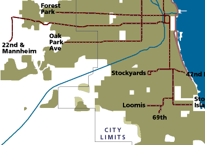 |
An animated series, created as a teaching tool for the University of Illinois at Chicago shows the city’s growth decade by decade, and the rapid transit and expressway lines in place at the time. See the complete animated series at the university’s website. |
|
|