| |

| |
S T R E E
T M A P S
We’ve
mapped our home town in great detail, plus a number of smaller cities
for Qwest Dex phone directories. Unlike most vendors of street maps, we
do extensive field checking to ensure accuracy.
|
|
|
|
 |
The
only up-to-date, field-checked base map of Chicago was the starting point
for this map showing bike lanes and other recommended streets for bicyclists.
See a
special web version here. |
| |
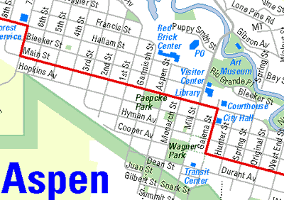 |
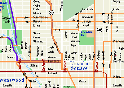
Days
of field checking ensures that the street maps done for Qwest Dex phone
books are accurate, up-to-date, and useful—showing landmarks, tourist
attractions, and even ski lifts. |
| |
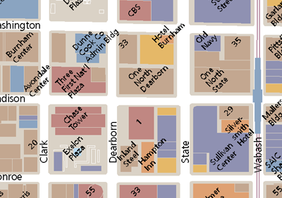 |
Every
building shows up in this detailed database of Chicago’s Central Area,
from Chicago to Roosevelt, Halsted to the lake. Keeping up with new construction
and name changes requires continuous fieldwork. |
| |
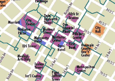 |
For
past real estate assignments, we’ve created detailed maps of virtually
every US downtown. In Minneapolis, it was important to show the downtown
skyway network. |
| |
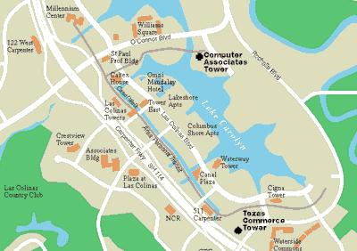 |
We’ve
created maps showing office developments, hotels, and major retail centers
for most of the nation’s suburban business centers, including Las Colinas,
near Dallas. |
| |
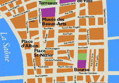 |
The
various attractions of the heart of Lyon, France, are easy to find in this
map for visitors. |
| |
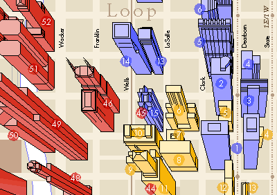 |
The
world-famous shapes of Chicago’s skyscrapers distinguish this map,
given to those taking Chicago Architecture Foundation tours |
|
|
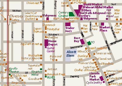 |
Maps showing neighborhood amenities such as schools, shopping,
transit, and other points of interest helps Koenig & Strey and other real estate companies market new condominiums. |
|